2018-10-29 00:07:56 +01:00
|
|
|
# QtPBFImagePlugin
|
2018-10-29 01:04:26 +01:00
|
|
|
Qt image plugin for displaying Mapbox vector tiles
|
|
|
|
|
|
|
|
|
|
## Description
|
|
|
|
|
QtPBFImagePlugin is a Qt image plugin that enables applications capable of
|
2019-01-03 01:44:57 +01:00
|
|
|
displaying raster MBTiles maps or raster XYZ online maps to also display
|
|
|
|
|
PBF(MVT) vector tiles without (almost, see usage) any application modifications.
|
2018-10-29 01:04:26 +01:00
|
|
|
|
2018-11-17 22:09:32 +01:00
|
|
|
Standard Mapbox GL Styles are used for styling the maps. Most relevant style
|
2021-07-16 22:23:58 +02:00
|
|
|
features used by [Maputnik](https://maputnik.github.io/editor) are supported.
|
2020-04-09 22:47:21 +02:00
|
|
|
A default fallback style (OSM-Liberty) for OpenMapTiles is part of the plugin.
|
2018-10-29 01:04:26 +01:00
|
|
|
|
2018-11-28 23:56:07 +01:00
|
|
|
"Plain" PBF files as well as gzip compressed files (as used in MBTiles) are
|
2019-10-05 18:47:39 +02:00
|
|
|
supported by the plugin. The tile size is (since version 2.0 of the plugin) 512px
|
|
|
|
|
to fit the styles and available data (OpenMapTiles, Mapbox tiles).
|
2018-11-28 23:56:07 +01:00
|
|
|
|
2018-10-29 01:04:26 +01:00
|
|
|
## Usage
|
2018-10-29 22:23:41 +01:00
|
|
|
Due to a major design flaw in the Mapbox vector tiles specification - the zoom
|
|
|
|
|
is not part of the PBF data - the plugin can not be used "as is", but passing
|
2018-11-01 23:29:53 +01:00
|
|
|
the zoom level is necessary. This is done by exploiting the optional *format*
|
2018-10-29 01:04:26 +01:00
|
|
|
parameter of the QImage constructor or the QImage::fromData() or
|
|
|
|
|
QPixmap::loadFromData() functions. The zoom number is passed as ASCII string
|
|
|
|
|
to the functions:
|
|
|
|
|
```cpp
|
|
|
|
|
QPixmap pm;
|
2023-12-10 08:18:16 +01:00
|
|
|
pm.loadFromData(tileData, QByteArray::number(zoom));
|
2018-10-29 01:04:26 +01:00
|
|
|
```
|
2023-12-10 15:53:19 +01:00
|
|
|
|
|
|
|
|
For a complete code sample see the [pbf2png](https://github.com/tumic0/pbf2png)
|
|
|
|
|
conversion utility.
|
|
|
|
|
|
|
|
|
|
### HiDPI
|
2018-11-17 22:09:32 +01:00
|
|
|
The plugin supports vector scaling using QImageReader's setScaledSize() method,
|
|
|
|
|
so when used like in the following example:
|
|
|
|
|
```cpp
|
2023-12-10 08:18:16 +01:00
|
|
|
QImageReader reader(file, QByteArray::number(zoom));
|
2019-10-05 18:49:34 +02:00
|
|
|
reader.setScaledSize(QSize(1024, 1024));
|
2018-11-17 22:09:32 +01:00
|
|
|
reader.read(&image);
|
|
|
|
|
```
|
2019-10-05 18:49:34 +02:00
|
|
|
you will get 1024x1024px tiles with a pixel ratio of 2 (= HiDPI tiles).
|
2018-10-29 01:04:26 +01:00
|
|
|
|
2023-12-10 15:53:19 +01:00
|
|
|
### Overzoom
|
2023-12-10 15:19:35 +01:00
|
|
|
Since version 2.7 tile overzoom is supported. If you set *format* to
|
|
|
|
|
`$zoom;$overzoom`:
|
2023-12-10 15:16:23 +01:00
|
|
|
```cpp
|
|
|
|
|
QPixmap pm;
|
|
|
|
|
pm.loadFromData(tileData, QByteArray::number(zoom) + ';' +
|
|
|
|
|
QByteArray::number(overzoom));
|
|
|
|
|
```
|
|
|
|
|
you will get (512<<overzoom)x(512<<overzoom)px tiles with a pixel ratio of 1.
|
|
|
|
|
When overzoom is combined with setScaledSize(), the base size is the overzoomed
|
|
|
|
|
tile size.
|
|
|
|
|
|
2020-04-09 22:47:21 +02:00
|
|
|
## Styles
|
|
|
|
|
The map style is loaded from the
|
|
|
|
|
[$AppDataLocation](http://doc.qt.io/qt-5/qstandardpaths.html)/style/style.json
|
|
|
|
|
file on plugin load. If the style uses a sprite, the sprite JSON file must
|
|
|
|
|
be named `sprite.json` and the sprite image `sprite.png` and both files must be
|
2020-04-10 13:13:20 +02:00
|
|
|
placed in the same directory as the style itself. *A style compatible with the
|
2022-06-08 01:02:04 +02:00
|
|
|
tiles data schema (Mapbox, OpenMapTiles, Tilezen, Ordnance Survey, Esri, ...)
|
|
|
|
|
must be used.*
|
2020-04-09 22:47:21 +02:00
|
|
|
|
|
|
|
|
For a list of "ready to use" styles see the
|
|
|
|
|
[QtPBFImagePlugin-styles](https://github.com/tumic0/QtPBFImagePlugin-styles)
|
|
|
|
|
repository.
|
|
|
|
|
|
2018-10-29 01:04:26 +01:00
|
|
|
## Build
|
2018-11-04 09:13:36 +01:00
|
|
|
### Requirements
|
2020-12-29 10:50:49 +01:00
|
|
|
* Qt5 >= 5.11 or Qt6
|
2018-10-29 01:04:26 +01:00
|
|
|
* Google Protocol Buffers (protobuf-lite)
|
2018-11-01 23:29:53 +01:00
|
|
|
* Zlib
|
2018-10-29 01:04:26 +01:00
|
|
|
|
2018-11-04 09:13:36 +01:00
|
|
|
### Build steps
|
2018-11-04 09:12:36 +01:00
|
|
|
#### Linux
|
2018-10-29 01:04:26 +01:00
|
|
|
```shell
|
2018-10-29 01:13:03 +01:00
|
|
|
qmake pbfplugin.pro
|
2018-10-29 01:04:26 +01:00
|
|
|
make
|
|
|
|
|
```
|
2018-11-04 09:12:36 +01:00
|
|
|
#### Windows
|
|
|
|
|
```shell
|
|
|
|
|
qmake PROTOBUF=path/to/protobuf ZLIB=path/to/zlib pbfplugin.pro
|
2018-11-06 01:45:26 +01:00
|
|
|
nmake
|
2018-11-04 09:12:36 +01:00
|
|
|
```
|
2018-11-17 22:09:32 +01:00
|
|
|
#### OS X
|
|
|
|
|
```shell
|
|
|
|
|
qmake PROTOBUF=path/to/protobuf pbfplugin.pro
|
|
|
|
|
make
|
|
|
|
|
```
|
2018-10-29 01:04:26 +01:00
|
|
|
|
|
|
|
|
## Install
|
|
|
|
|
Copy the plugin to the system Qt image plugins path to make it work. You may
|
2018-12-08 18:44:37 +01:00
|
|
|
also set the QT_PLUGIN_PATH system variable before starting the application. For
|
|
|
|
|
Linux, there are RPM and DEB [packages](https://build.opensuse.org/project/show/home:tumic:QtPBFImagePlugin)
|
|
|
|
|
for most common distros available on OBS.
|
2018-10-29 01:04:26 +01:00
|
|
|
|
|
|
|
|
## Limitations
|
2018-12-17 21:59:06 +01:00
|
|
|
* Only data that is part of the PBF file is displayed. External layers defined in the
|
2018-12-16 17:54:56 +01:00
|
|
|
style are ignored.
|
|
|
|
|
* Text PBF features must have a unique id (OpenMapTiles >= v3.7) for the text layout
|
2018-11-10 14:28:57 +01:00
|
|
|
algorithm to work properly.
|
2020-04-09 22:47:21 +02:00
|
|
|
* Expressions are not supported in the styles, only property functions are implemented.
|
2018-10-29 22:15:57 +01:00
|
|
|
|
2019-10-05 22:06:37 +02:00
|
|
|
## Changelog
|
|
|
|
|
[Changelog](https://build.opensuse.org/package/view_file/home:tumic:QtPBFImagePlugin/QtPBFImagePlugin/libqt5-qtpbfimageformat.changes)
|
|
|
|
|
|
2018-10-29 22:15:57 +01:00
|
|
|
## Status
|
2020-04-09 23:42:02 +02:00
|
|
|
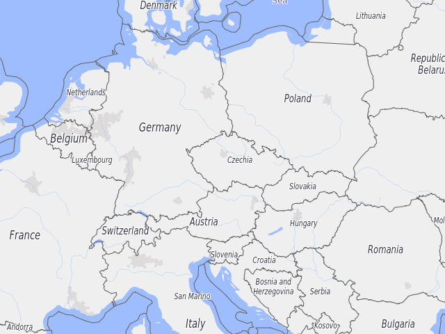
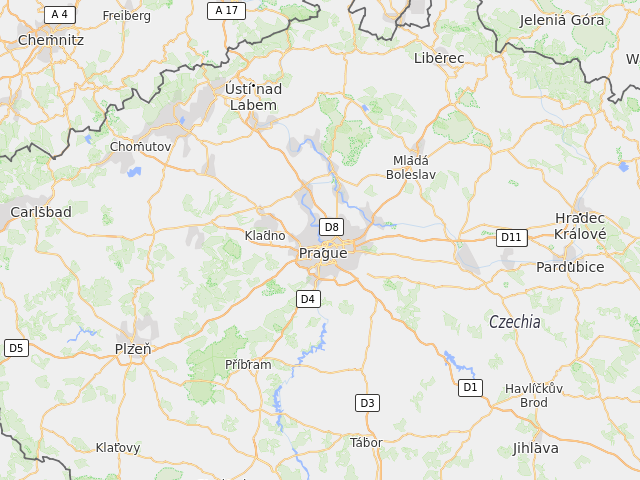
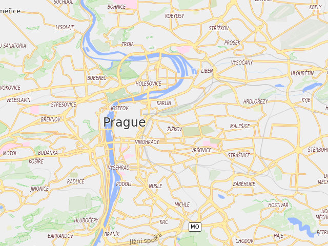
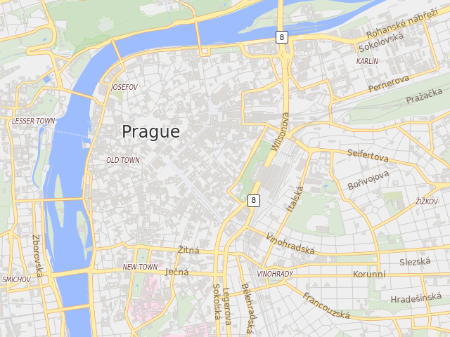
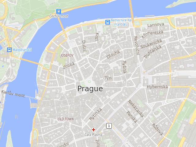
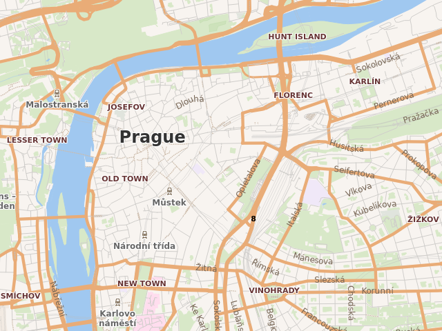
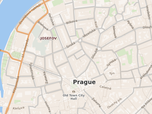
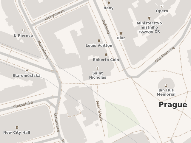
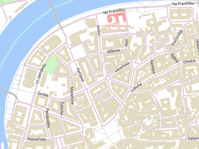
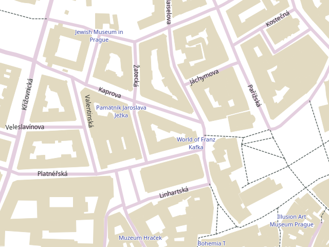
A picture is worth a thousand words.
|
2020-04-11 11:27:17 +02:00
|
|
|
#### OpenMapTiles
|
|
|
|
|
|
|
|
|
|
* Data: [MapTiler](https://github.com/tumic0/GPXSee-maps/blob/master/World/MapTiler.tpl)
|
|
|
|
|
* Style: [OSM-liberty](https://github.com/tumic0/QtPBFImagePlugin-styles/blob/master/OpenMapTiles/osm-liberty/style.json)
|
|
|
|
|
|
2018-10-29 22:15:57 +01:00
|
|
|
|
2018-11-10 14:28:57 +01:00
|
|
|
|
2020-04-09 23:42:02 +02:00
|
|
|
|
2018-10-29 22:15:57 +01:00
|
|
|
|
2020-04-09 23:42:02 +02:00
|
|
|
|
2018-10-29 22:15:57 +01:00
|
|
|
|
2020-04-11 11:27:17 +02:00
|
|
|
#### Mapbox
|
|
|
|
|
|
|
|
|
|
* Data: [Mapbox](https://github.com/tumic0/GPXSee-maps/blob/master/World/Mapbox.tpl)
|
|
|
|
|
* Style: [Bright](https://github.com/tumic0/QtPBFImagePlugin-styles/blob/master/Mapbox/bright/style.json)
|
|
|
|
|
|
2020-04-09 23:42:02 +02:00
|
|
|
|
|
|
|
|
|
2020-04-11 11:49:37 +02:00
|
|
|
|
|
|
|
|
|
|
|
|
|
|
|
|
|
|
|
|
|
|
|
#### Tilezen
|
|
|
|
|
|
|
|
|
|
* Data: [HERE](https://github.com/tumic0/GPXSee-maps/blob/master/World/here-vector.tpl)
|
|
|
|
|
* Style: [Apollo-Bright](https://github.com/tumic0/QtPBFImagePlugin-styles/blob/master/Tilezen/apollo-bright/style.json)
|
|
|
|
|
|
|
|
|
|
|
|
|
|
|
|
|
|
|
|
|
|
|
|
|
|
|
|
|
|
|
2018-10-29 22:20:31 +01:00
|
|
|
|
2018-12-09 11:25:27 +01:00
|
|
|
## Applications using QtPBFImagePlugin
|
2018-12-09 11:22:33 +01:00
|
|
|
* [GPXSee](https://www.gpxsee.org)
|