
What is GPXSee?
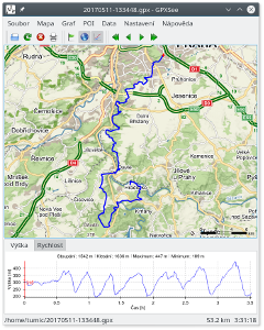
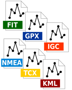
GPXSee is a GPS log file viewer and analyzer that supports GPX, TCX, KML, FIT, IGC and NMEA files.
Key features
- User-definable online maps.
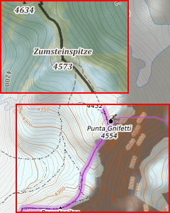
- Offline maps (OziExplorer maps, TrekBuddy maps/atlases, GeoTIFF images).
- Elevation, speed, heart rate, cadence, power and temperature graphs.
- Support for multiple tracks in one view.
- Support for POI files.
- Print/export to PDF.
- Full-screen mode.
- Native GUI (Qt) for Windows, Mac OS X and Linux.
- Opens GPX, TCX, FIT, KML, IGC, NMEA and Garmin CSV files.
- Free software (GPLv3 open-source license).
GPXSee is designed as a small (no dependencies except of Qt), fast and uncomplicated GPS data/map viewer, not a full featured GIS software. However, the spectrum of supported data files/map sources is relatively rich, see the Documentation section for details.
Download
Additionally to the source codes, GPXSee is available as a Windows installer and an OS X dmg from the project's Sourceforge page and in form of various Linux packages from the project's openSUSE Build Service page. Some linux distributions (e.g. openSUSE or Fedora) also provide GPXSee in their official repositories.
Reporting bugs
If you have found some bug in GPXSee, please report it using the GitHub issue tracker. Bugs that are not reported can not be fixed! If you are missing some feature in GPXSee, you may also use the tracker to request it.