mirror of
https://github.com/tumic0/GPXSee.git
synced 2025-07-22 14:54:24 +02:00
e34f77f1a128aa4c80dccda7cf405ffa0d1f4d83
Many file URLs/paths that are passed to GPXSee on Android are unusable for
extracting the file suffix due to the Android file name mangling. Use
the converted "display names" for suffix extraction where possible.
GPXSee
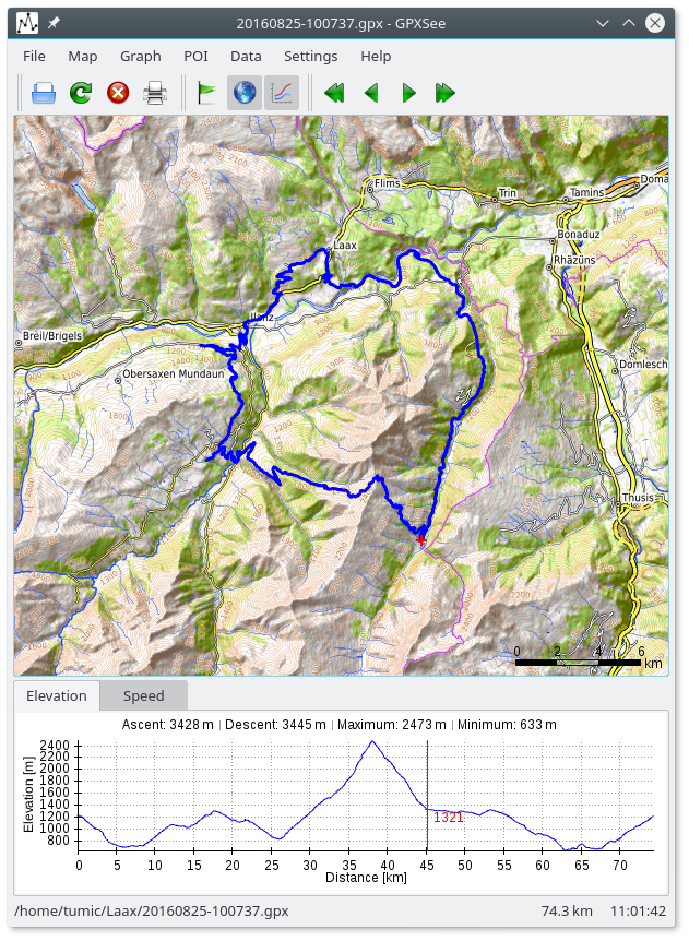
GPXSee is a Qt-based GPS log file viewer and analyzer that supports all common GPS log file formats.
Features
- Opens GPX, TCX, FIT, KML, NMEA, IGC, CUP, SIGMA SLF, Suunto SML, LOC, GeoJSON, OziExplorer (PLT, RTE, WPT), Garmin GPI&CSV, TomTom OV2&ITN, ONmove OMD/GHP, TwoNav (TRK, RTE, WPT) and geotagged JPEG files.
- User-definable online maps (OpenStreetMap/Google tiles, WMTS, WMS, TMS, QuadTiles).
- Offline maps (MBTiles, OziExplorer maps, TrekBuddy maps/atlases, Garmin IMG/GMAP & JNX maps, TwoNav RMaps, GeoTIFF images, BSB charts, ENC charts, KMZ maps, AlpineQuest maps, Locus/OsmAnd/RMaps SQLite maps, Mapsforge vector maps, QCT maps, GEMF maps, Osmdroid SQLite maps, Orux maps, ESRI World-File georeferenced images).
- Elevation, speed, heart rate, cadence, power, temperature and gear ratio/shifts graphs.
- Support for DEM files (SRTM HGT).
- Support for multiple tracks in one view.
- Support for POI files.
- Print/export to PDF/PNG.
- Full-screen mode.
- HiDPI/Retina displays & maps support.
- Real-time GPS position.
- Windows, macOS, Linux and Android builds.
Build
Build requirements:
- Qt5 >= 5.11 or Qt6 >= 6.2 (Android builds require Qt6)
- C++11 or newer compiler (tested: msvc2019, gcc 7.5.0, clang/Apple LLVM version 10.0.0)
Build steps:
lrelease gpxsee.pro
qmake gpxsee.pro
make # nmake on windows
Download
Changelog
Homepage
Maps
Translations
GPXSee uses Weblate for translations.
License
GPXSee is licensed under GPL-3.0 (only). However, some 3rd party parts are using different, GPL compatible, licenses:
- Oxygen icons - LGPLv3
- Mapbox Maki icons - CC0
- Map Icons Collection - CC BY SA 3.0
- RTree implementation - Public domain
- Albers, Geocentric, LCC, Mercator, Polar Stereographic, Polyconic and Transverse Mercator projections - NIMA Source Code Disclaimer
- Projection parameters CSV files - BSD/EPSG/Public domain
- Mapsforge render theme and its icons - LGPLv3
Languages
C++
97%
NSIS
1.2%
QMake
1%
C
0.7%
